After Portland, there was quite a bit of uncertainty as to whether another round of storms would occur. I simply headed back towards Saginaw, keeping an eye on satellite and what was going on when I could visually see cumulus towers shooting incredibly high up, before crashing down and firing a new one in a different location. It became apparent at this point that once the cap eroded just a tiny bit more, violent storms would be possible. As I got to Breckenridge, I took awhile to shoot a time lapse with the gopro, which would actually become the initiation of the line of cells that would soon come.

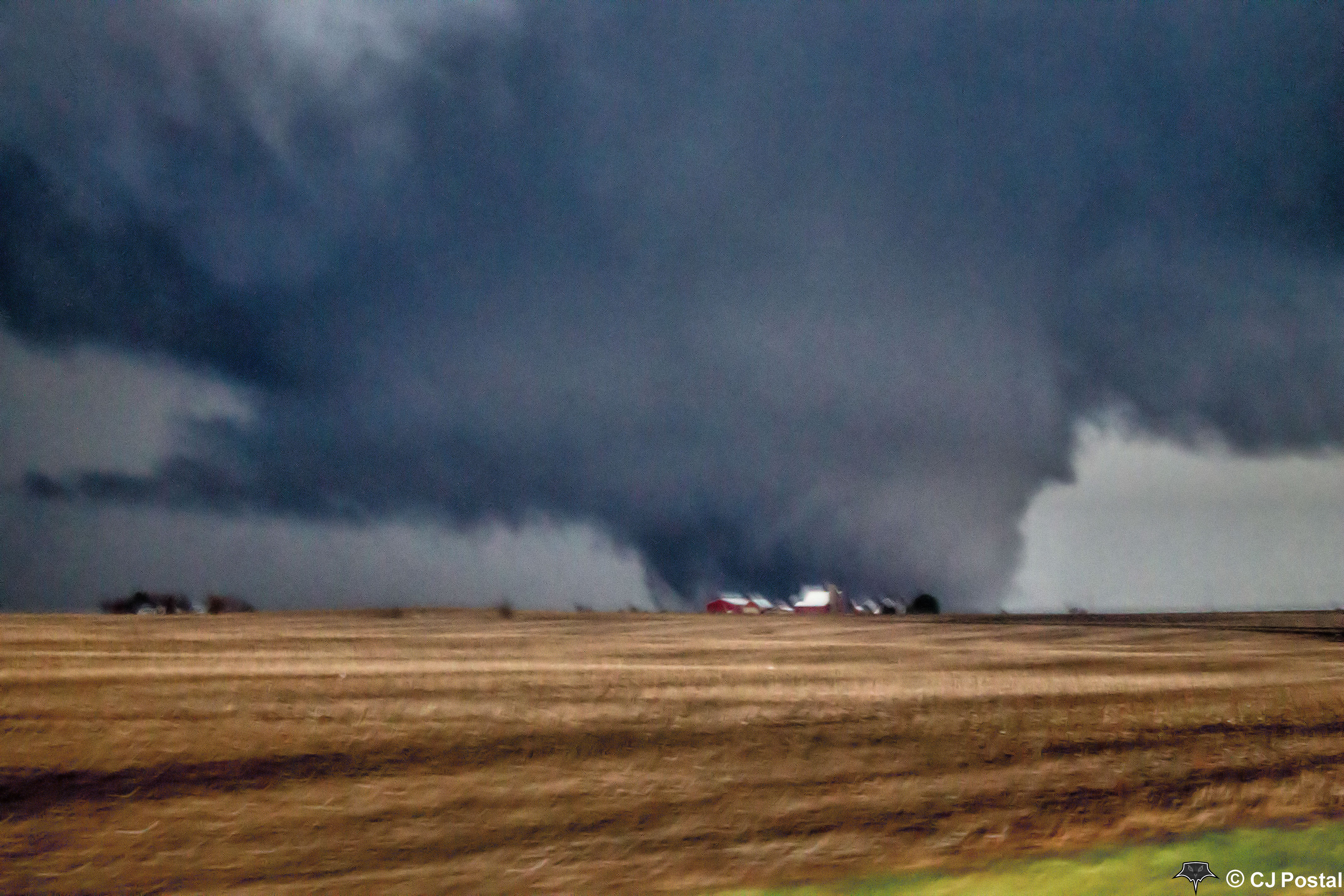
Central Gratiot County as storms began to organize.
The line of cells began very modestly, then intensified rapidly around 8-8:30PM. A cell in Gratiot Co. became dominant and had some supercellular characteristics, which combined with my knowledge of the road network in the area, became the clear favorite for which storm I would chase. I moved from NE of Breckenridge southward to the east central area of Gratiot Co. Stopped to shoot video and a few pictures, then proceeded east on Washington/Ithaca Rd.

Lightning screen shot while capturing video along Washington Rd. in east-central Gratiot County

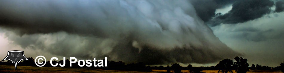
Thunderstorm closing in on St. Charles, MI
10 miles to the east was the home I grew up in as a teenager outside of Brant, which provided a great photo op for structure of the entire storm; which you could now see rotating broadly. While driving through St. Charles and continuing east, the cell began to cycle numerous times pulling moisture around the updraft then briefly clearing out – each time pulling a larger wall cloud out of the rain as the storm cut its way through central Saginaw County. Once I crossed M-13 and was headed towards Birch Run, an extremely low wall cloud was now skimming just over treetops to my north. No warning as of yet (though I had called 911 after the wall cloud began rotating), so I called local meteorologist and friend Ahmad Bajjey. After a quick conversation, the skies of darkness closed in while the sun set, and a dangerous situation was unfolding directly in front of me.
Driving into the village limits of Birch Run and trying to frantically call my best friend who lives on the other side of town to tell him and his family to shelter, visibility became horrible. As I drove past the fire station, the outdoor sirens kicked on in my ear, sending a quick chill down my spine as I was directly paralleling the bears cage as it targetted the closest village east of my hometown.
At this point, I pretty much let instinct and what I could see take over. Driving onto the Birch Run Road overpass for I-75 and watching the wind flow around my car in combination with where it was headed on radar – I stopped to try and gain a visual on the rotation to my northeast. Just on the other side of a hotel and heading directly for a Meijer grocery store, was a violent rotation maybe 400 feet off the ground. You could see rain curtains whipping around the circulation at amazing speeds through parking lot and building lights – but no power flashes and no power loss yet. Using that as my confirmation that I was not driving DIRECTLY into a tornado, I began to inch forward – carefully using the direction the rain was headed to compare my position to the bears cage.
Funnel cloud east of Birch Run, MI just prior to tornado birth.
2 miles ahead, I noticed the wind shifted as I was driving to a point where I was in the inflow. I stopped and waited to gain a visual on whether I could continue or not, when I could just BARELY see a large funnel through flashes of lightning about 1/8th of a mile to my north. This was about 20 seconds before the tornado path began. From here east, most of the area to the north is wooded areas so there was nothing to really see – but I continued east, inching along watching the wind and rain and using it as my compass to where hell was consuming the earth alongside and in front of my vehicle. I made it another 6 miles, before watching about 15 trees get taken down by the tornado about a football field in front of me. Chase over.
At this point I went house to house where I could on the west hand side of the damage. After ensuring those who I could actually get to were OK, I awaited emergency personnel to arrive before assisting in another search of a house further back in the woods. Despite everything around the house being destroyed, it did fairly well in the tornado and by the time me and a firefighter made our way back through the insane tree and power line carnage – we found out the owner was on vacation and was down in Florida – nothing else to worry about.
After this, I finally got ahold of my friend Kyle and made sure him and his family were ok, before heading there for a trip to say hi. Before leaving his house, I went to the RV park just north of his house for an interview and another inspection of some damage. This is where the only two injuries from the storm happened, and fortunately no deaths occurred with this tornado or any other tornado on this day.
Once things calmed down from doing interviews, etc. I looked back at the damage survey and path and concluded the furthest distance I was from the tornado at any given point (prior to it crossing the road and blocking travel) was 2000 feet along a 6 mile portion of the damage path.

Damage along Birch Run Rd. west of Millington, MI

Damage along Birch Run Rd. west of Millington, MI

Tornado path vs. my path while paralleling it to the southwest. Original image courtesy of NWS Detroit

Radar imagery of tornado courtesy of NWS Detroit